
178,52 €
Produit Neuf
Ou 44,63 € /mois
- Livraison : 3,99 €
- Livré entre le 21 et le 28 septembre
Nos autres offres
-
159,86 €
Produit Neuf
Ou 39,97 € /mois
- Livraison : 25,00 €
- Livré entre le 5 et le 10 octobre
Apres acceptation de la commande, le delai moyen d'expedition depuis le Japon est de 48 heures. Le delai moyen de livraison est de 3 a 4 semaines. En cas de circonstances exceptionnelles, les delais peuvent s'etendre jusqu'à 2 mois.
Voir le détail de l'annonce

- Payez directement sur Rakuten (CB, PayPal, 4xCB...)
- Récupérez le produit directement chez le vendeur
- Rakuten vous rembourse en cas de problème

Gratuit et sans engagement
Félicitations !
Nous sommes heureux de vous compter parmi nos membres du Club Rakuten !
TROUVER UN MAGASIN
Retour
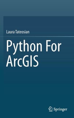
Avis sur Python For Arcgis de Laura Tateosian Format Relié - Livre Sciences de la vie et de la terre
0 avis sur Python For Arcgis de Laura Tateosian Format Relié - Livre Sciences de la vie et de la terre
Les avis publiés font l'objet d'un contrôle automatisé de Rakuten.
-
Collection Entremets & Petits Gâteaux
1 avis
Occasion dès 90,00 €
-
Catafalque
Neuf dès 86,94 €
-
I Want To Spend The Rest Of My Life Everywhere, With Everyone, One To One, Always, Forever, Now
Occasion dès 96,88 €
-
Behind Bars: The Definitive Guide To Music Notation
Neuf dès 101,68 €
-
Song Book - Intégrale --- Chant, Guitare Ou Piano
Occasion dès 100,00 €
-
Pierre Bayle
Neuf dès 222,62 €
-
The Fourth World Omnibus Vol. 2
Neuf dès 134,88 €
-
By Marc Pairon Art Deco Ceramics Made In Belgium: Charles Catteau
6 avis
Occasion dès 110,00 €
-
Quantum Electrodynamics Of Strong Fields
Neuf dès 211,28 €
-
Geometric Quantization And Quantum Mechanics
Neuf dès 123,61 €
-
Harald Szeemann
Neuf dès 87,99 €
-
The Globalization Of World Politics
Neuf dès 87,03 €
-
Didactique De L'anglais - Tome 2, La Mise En Oeuvre Pédagogique
Occasion dès 82,63 €
-
Advanced Quantum Mechanics
Neuf dès 145,54 €
-
Te Linde's Operative Gynecology
Neuf dès 103,99 €
-
Rules, Patterns And Words
Neuf dès 80,00 €
-
Common Sense
Occasion dès 115,00 €
-
Götz Von Berlichingen
2 avis
Occasion dès 85,00 €
-
Custom Lettering Of The '60s & '70s
Occasion dès 162,00 €
-
The Twilight Saga Deluxe Hardcover Collection
Neuf dès 223,38 €
Occasion dès 85,00 €
Produits similaires
Présentation Python For Arcgis de Laura Tateosian Format Relié
- Livre Sciences de la vie et de la terre


Résumé :
This book introduces Python scripting for geographic information science (GIS) workflow optimization using ArcGIS. It builds essential programming skills for automating GIS analysis. Over 200 sample Python scripts and 175 classroom-tested exercises reinforce the learning objectives. Readers will learn to: ? Write and run Python in the ArcGIS Python Window, the PythonWin IDE, and the PyScripter IDE ? Work with Python syntax and data types ? Call ArcToolbox tools, batch process GIS datasets, and manipulate map documents using the arcpy package ? Read and modify proprietary and ASCII text GIS data ? Parse HTML web pages and KML datasets ? Create Web pages and fetch GIS data from Web sources. ? Build user-interfaces with the native Python file dialog toolkit or the ArcGIS Script tools and PyToolboxes Python for ArcGIS is designed as a primary textbook for advanced-level students in GIS. Researchers, government specialists and professionals working in GIS will also find this book useful as a reference.
Biographie:
Laura G. Tateosian is a professor at the Center for Geospatial Analytics at North Carolina State University. She earned her B.A. in Mathematics from Towson University, her M.S. in Mathematics from the University of Oklahoma, and her Ph.D. in computer science from North Carolina State University. She has more than 8 years of experience teaching Python programming for GIS and receives outstanding teaching evaluations. In 2014, she received an award for her teaching at North Carolina State University. Her research involves geospatial data analysis, aesthetic geovisualization, eye-tracking for map and visualization design, and automatic narrative mapping with Python and ArcGIS. Her research has published in refereed conferences and journals, such as, Information Visualization, International Journal for Uncertainty Quantification, Transactions in GIS, ACM Transactions on Graphics, IEEE Transactions on Visualization and Computer Graphics, the proceedings of the International Symposium on Non-Photorealistic Animation and Rendering, the International Symposium on Applied Perception in Graphics and Visualization, and IEEE Computer Graphics & Applications (Visualization Viewpoints).
Sommaire:
Laura G. Tateosian is a professor at the Center for Geospatial Analytics at North Carolina State University. She earned her B.A. in Mathematics from Towson University, her M.S. in Mathematics from the University of Oklahoma, and her Ph.D. in computer science from North Carolina State University. She has more than 8 years of experience teaching Python programming for GIS and receives outstanding teaching evaluations. In 2014, she received an award for her teaching at North Carolina State University. Her research involves geospatial data analysis, aesthetic geovisualization, eye-tracking for map and visualization design, and automatic narrative mapping with Python and ArcGIS. Her research has published in refereed conferences and journals, such as, Information Visualization, International Journal for Uncertainty Quantification, Transactions in GIS, ACM Transactions on Graphics, IEEE Transactions on Visualization and Computer Graphics, the proceedings of the International Symposium on Non-Photorealistic Animation and Rendering, the International Symposium on Applied Perception in Graphics and Visualization, and IEEE Computer Graphics & Applications (Visualization Viewpoints)....
Détails de conformité du produit
Personne responsable dans l'UE